The Indian Meteorological Department (IMD) has issued an important weather update. September 2025 is likely to bring above-normal rainfall across most of the country, creating both opportunities and challenges for millions. From agriculture to urban life, the forecast sets the stage for a month that could be wetter than usual, sparking discussions around climate shifts, safety measures, and preparedness.
According to IMD’s latest outlook, the all-India average rainfall for September 2025 is expected to be over 109% of the long-period average (LPA). In simpler terms, most regions can anticipate higher-than-usual showers, with the possibility of intense rainfall episodes in states like Uttarakhand, Rajasthan, Delhi, Haryana, and parts of Chhattisgarh.
The forecast also highlights the risks of urban flooding, landslides, mudslides, and flash floods, especially in vulnerable areas. Authorities have been urged to remain on high alert, ensuring they are prepared for any extreme weather events.
While much of the country may see surplus showers, the IMD has pointed out that parts of northeast India, eastern states, extreme southern peninsular regions, and some northernmost areas could record below-normal rainfall.
This regional variation paints a complex picture, where some areas may face overflowing rivers and floods, while others could continue struggling with drier-than-expected conditions.
Why September Rains Are Rising?
Interestingly, meteorologists have observed a consistent increase in September rainfall since the 1980s. One of the main reasons is the gradual shift in monsoon withdrawal dates, which have been moving from September 1 to around September 17 in recent decades.
This extended stay of the monsoon, combined with western disturbances interacting with the monsoon system, has led to heavier rainfall during what is traditionally considered the transition phase of the season.
The current forecast comes after an eventful August. IMD’s data revealed that northwest India and the southern peninsula received rainfall far above normal levels, marking one of the heaviest Augusts in nearly three decades. These heavy showers triggered landslides in Himachal Pradesh, flash floods in Jammu & Kashmir, and crop losses in Punjab’s farmlands.
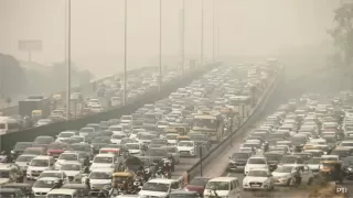
For many cities, including Delhi and Chennai, urban flooding episodes disrupted daily life, showing how quickly extreme weather can impact modern infrastructure.
The IMD has also shed light on the growing concern of mini-cloudbursts, short, intense rain spells that may not meet the threshold of a traditional cloudburst but still cause significant damage.
- A cloudburst is when rainfall crosses 100 mm per hour over a small region (20-30 sq km).
- A mini-cloudburst is when rainfall intensity touches 50 mm per hour, still capable of causing landslides, flash floods, and waterlogging.
These phenomena are increasingly being reported not just in the Himalayan belt and Western Ghats, but also in coastal and metropolitan areas, as seen in Chennai’s recent downpour.
For everyday citizens, the forecast is a reminder to stay alert, farmers need to adapt crop planning, cities must prepare drainage systems, and travellers should keep an eye on weather warnings. For policymakers, it is a call to action to strengthen disaster management systems and climate-resilient infrastructure.
India’s September skies may bring life-giving rains for agriculture, but they also highlight the growing unpredictability of the monsoon.
Also Read: Bank Holidays in India September 1-7, 2025: Full List